 What's My Connection to Mountaintop Removal?
NOTE: THE DATA USED BY THIS TOOL IS NOT UP TO DATE
Please visit the MyConnection methodology page HERE to learn when the data used by this tool was last updated. While
there are no plans to update this data, notice will be given here and on the methodology page should an update occur.
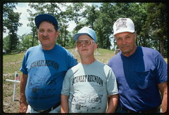
 The price of your power: Kayford Mountain, West Virginia
"Mountaintop mining is practically raising the dead, while burying the living." - Larry Gibson, resident of Kayford mountain


In 1986, mountaintop removal operations began near Larry Gibson's home. Over the next 20 years, "the slow motion destruction of Kayford Mountain has been continuous - 24 hours a day, seven days a week." Coal companies have flattened more than 12,000 acres of mountain landscape around his home. Where he once looked up at the peaks of Kayford from his family graveyard, he now looks 300 feet straight down at a blasted and devastated landscape. Read more.
You are connected to mountaintop removal. Your electricity provider, Gulf Coast Electric Coop, Inc, uses coal from mountaintop removal mines
The story of Kayford Mountain, West Virginia, is one of many that are connected to the power plants on your grid, which are marked on the map below.
The mountaintop removal mines shown in red are connected to the nearest coal power plant on your grid: Charles R Lowman, operated by PowerSouth Energy Cooperative.
Click on the mine symbols to take a closer look in Google Maps, or click here for a detailed explanation.

Want to Break Your Connection?
1. Join the 132,446 people that have already
pledged to help end mountaintop removal.
Tell me more
2. Ask your Senators and Representative to support
legislation to end mountaintop removal coal mining.
3. Tell others about this page
4. Buy Green Power. CLICK HERE to find
Green Power Programs in your state!
 View
your connection in Google Earth (KML)
|
LEGEND: |
|
|
|
NAVIGATION HINTS: |
Click any power plant to see how it is connected to mountaintop removal or any mine symbol to get a close-up view of that mine. The controls on the top left of the map allow you to zoom in closer to the ground or back out to get a broader perspective. Even easier, though, is to navigate with the "hand" tool. Clicking and dragging on the map will move the map in the same direction, double-clicking on a point will center the map on that point and zoom you in a little closer, and double clicking with the right mouse button (ctrl-click for macintosh users) to center on a point and zoom out. |
Explain My Connection
WHO PROVIDES MY ELECTRICITY?
The Gulf Coast Electric Coop, Inc service area is part of a larger interconnected electric grid operated by PowerSouth Energy Cooperative.
There is a total of 1 coal-fired power plant on this grid that is connected to mountaintop removal. Following are details on how it is connected to mountaintop removal.
If Gulf Coast Electric Coop, Inc is not the company that sends your electric bill, please CLICK HERE to select your electric provider from a list.
If your electric provider is not on these lists, please notify us
Plants on the PowerSouth Energy Cooperative grid that purchase coal directly from mountaintop removal strip mines in Appalachia include:
- Charles R Lowman , operated by PowerSouth Energy Cooperative -- located in Washington County, AL
Appalachian Voices • Coal River Mountain Watch • Heartwood • Keeper of the Mountains • Kentuckians for the Commonwealth
Ohio Valley Environmental Coalition • Statewide Organizing for Community eMpowerment • Sierra Club Environmental Justice
Southern Appalachian Mountain Stewards • SouthWings • Stay Project • West Virginia Highlands Conservancy

Site produced by Appalachian Voices 589 West King St, Boone, NC 28607 ~ 1-877-APP-VOICE (277-8642) ~ ilm-webmaster@ilovemountains.org


