 What’s My Connection to Mountaintop Removal?
NOTE: THE DATA USED BY THIS TOOL IS NOT UP TO DATE
Please visit the MyConnection methodology page HERE to learn when the data used by this tool was last updated. While there are no plans to update this data, notice will be given here and on the methodology page should an update occur.
|
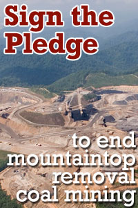
Mountaintop removal is a radical form of coal mining where entire mountains are literally blown up — devastating communities throughout Appalachia, polluting drinking water and destroying rivers. If your home or business is on the electric grid, chances are you are connected to mountaintop removal in the Appalachian Mountains. Find out how – and then find out what you can do about it.
|
|
|||||||||
Information Sources for “What’s My Connection?”
The “What’s My Connection?” feature was built from a variety of data sources that were compiled by Appalachian Voices between September 2007 to 2015. Connection results are based on all coal purchases by coal-based electricity providers for 2013 (the EIA’s most recent data.)
Specific sources of data for the “What’s My Connection?” feature are listed below.
-
Coal purchases by individual coal-fired power plants:
-
Monthly Schedule 2 EIA-923 forms utilities and nonutilities are required to supply to the Federal Energy Regulatory Commission, obtained from the Energy Information Administration.
-
-
Location, ownership, and power control areas of coal-fired power plants:
-
The eGRID2010 Version 1.1 database released from the Environmental Protection Agency on 02/24/2014.
-
-
Location and ownership of coal mines:
-
The “Mines Data Set” of all US coal mines supplied to Appalachian Voices by the Mine Safety and Health Administration in February, 2009.
-
-
Association of zip codes with electric service providers:
-
EIA Form 861 (2013), an annual survey of electric utilities by the Energy Information Administration.
-
-
Latitude and longitude of zip code centroid locations:
-
ZIPList5 Geocode table obtained from www.zipinfo.com in October, 2009.
-
-
Determination of mine types (i.e., mountaintop removal mines):
-
Comprehensive map of Appalachian mountaintop removal mine sites based on satellite imagery from 1976, 1985, 1995 and 2005, produced by Skytruth for Appalachian Voices in October, 2007. Landsat satellite images were purchased from the US Geologic Survey (USGS), and 1:100,000 scale digital elevation models of pre-1976 terrain were also provided by the USGS. Click here to see the detailed methodology of this study.
-


